 Loading…Loading…
Things to do
On our doorstep · 0 min
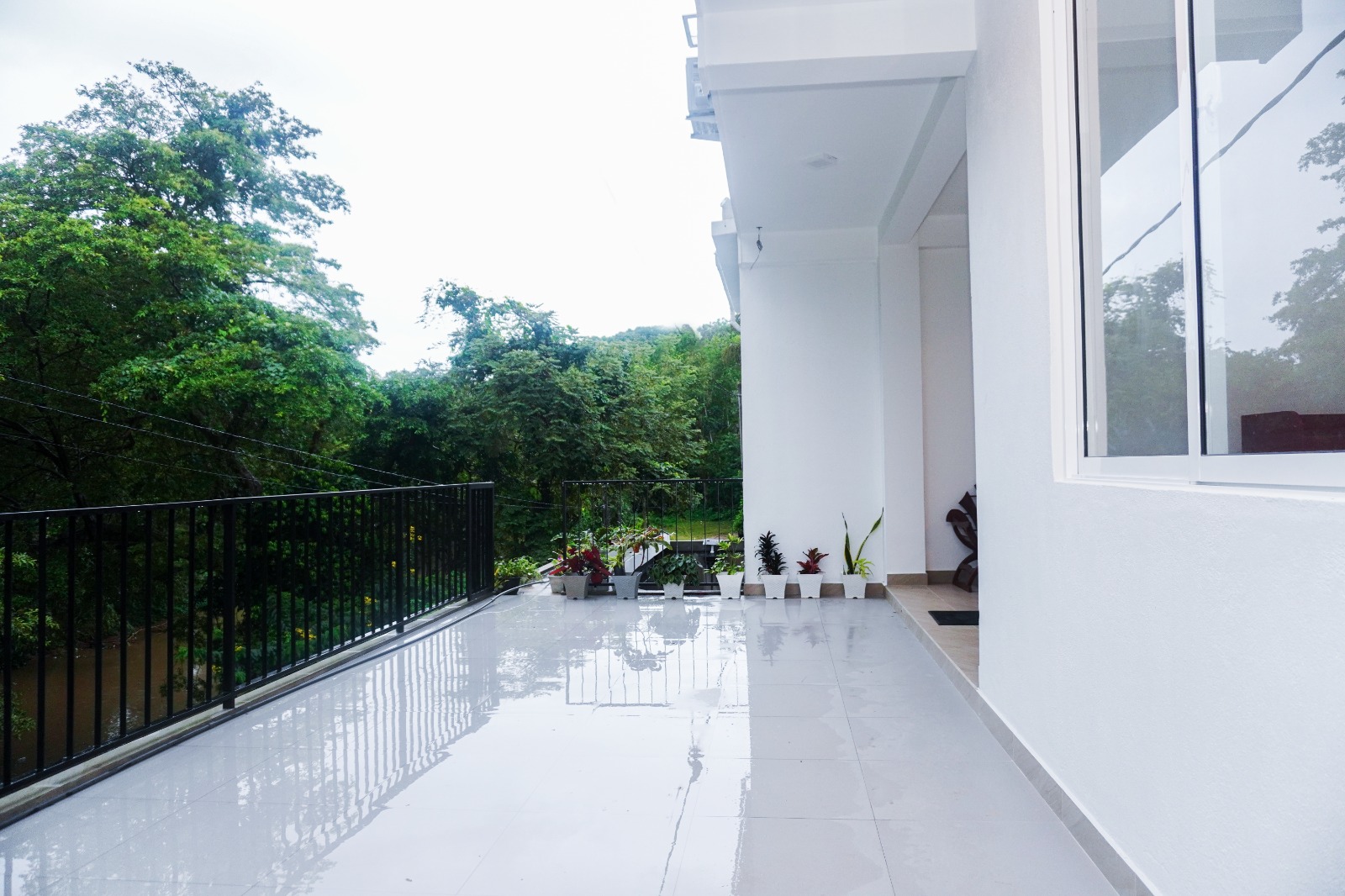
Just next to Romara Living, the river forms a natural spot for a cold plunge. Start the morning with a bracing dip, or cool off after a day of waterfalls and viewpoints, then warm up with a cup of tea on the balcony.
Ask us about the water level before you go in, especially after heavy rain.
Places to visit
Filter by drive time or by what you love. Times are approximate drive times from Romara Living and change with traffic, weather and road conditions. Ask us and we’ll help you plan the day.
Showing 20 places
Easy half-day trips: rivers, waterfalls and ancient sites close to Romara.
9 places

A forested river valley on the road into the hills. The cool, clear Belihul Oya runs over smooth rocks and natural pools, with riverside walks, paddy fields and village paths all around.
Pack a towel. The shallow pools are best on sunny mornings.
Directions from Romara to Belihuloya & the Belihul Oya (opens in a new tab)
A pretty forest waterfall near Belihuloya. Its name comes from the shape of the pool, like an old oil-lamp stand. It's an easy walk of about 20 minutes from the road.
Directions from Romara to Pahanthudawa Falls (opens in a new tab)
A favourite river-bathing spot just outside Belihuloya, along the road towards Nonpareil Estate, with clear water and rocks to sit on.
Directions from Romara to Hirikatu Oya (opens in a new tab)
A slender, 60-metre waterfall that drops in two stages down the hillside near Walhaputenna, and can be seen from the Colombo–Badulla road.
Directions from Romara to Surathali Ella (opens in a new tab)
A wide, hill-ringed reservoir where the Walawe River meets the Belihul Oya. It's peaceful for photographs and birdwatching, and local eco-lodges organise kayaking.
Directions from Romara to Samanalawewa Reservoir (opens in a new tab)
One of the oldest archaeological sites in the region. It has rock shelters with Brahmi inscriptions from the 2nd century BC, evidence of prehistoric life and a hilltop stupa with sweeping views. It's a place of worship for Buddhists and Muslims alike.
Dress modestly. Shoulders and knees should be covered.
Directions from Romara to Kuragala (opens in a new tab)Quiet forest-monastery ruins near Kaltota, with meditation platforms, a moonstone, carved lion figures and views across to Kuragala. The site dates back to at least the 2nd century BC.
Directions from Romara to Budugala Ancient Monastery (opens in a new tab)
A powerful 40-metre waterfall on the Walawe River near Kaltota. Its spray rises like dust, which gives it the name 'duwili'. The final stretch is a walk through forest.
Best with a local guide. Don't swim near the base when the river is high.
Directions from Romara to Duwili Ella (opens in a new tab)
A 116-metre fall in the forest near Kuttapitiya, towards Pelmadulla. Steps lead down to a viewing platform and on to the base, which takes about 30 minutes on foot.
A small entrance fee is charged locally.
Directions from Romara to Kirindi Ella (opens in a new tab)Full-day adventures into the hills, tea country and wildlife parks.
9 places

A dramatic horseshoe bend at about 1,500 m inside Nonpareil Estate. On a clear day you can see the Samanala and Udawalawe reservoirs and range after range of hills. The last 11 km is a rough estate road, so hire a jeep or three-wheeler at the bottom or hike up.
Go early. Mist often rolls in by midday. December to April is clearest.
Directions from Romara to Baker's Bend viewpoint (opens in a new tab)
Sri Lanka's tallest waterfall, a 263-metre ribbon of water near Kalupahana, framed by pine forest. Easy to reach from the road and at its most spectacular after rain.
Directions from Romara to Bambarakanda Falls (opens in a new tab)
A hill town perched on a ridge with views to both sides on a clear day. It's surrounded by tea estates and is a stop on the famous hill-country railway.
Directions from Romara to Haputale (opens in a new tab)
The centre of Sri Lanka's gem trade. Visit a gem museum, see traditional gem pits and browse the busy gem market streets.
Directions from Romara to Ratnapura, the City of Gems (opens in a new tab)
A 1931 Tudor-style country house near Haputale, built by planter Sir Thomas Villiers and now a Benedictine monastery, with English-style gardens in the hills.
Open to visitors on set days. Check before you go.
Directions from Romara to Adisham Bungalow (opens in a new tab)
One of the best places in Sri Lanka to see wild elephants, on a jeep safari across open grassland. Next to the park, the Elephant Transit Home cares for orphaned calves before returning them to the wild.
Morning and late-afternoon safaris are the most rewarding.
Directions from Romara to Udawalawe National Park (opens in a new tab)
Sri Lanka's second-highest waterfall, a single 220-metre drop near Koslanda. A popular hike leads to natural rock pools at the top with huge views.
Hike to the upper pools with a local guide, and only in dry weather.
Directions from Romara to Diyaluma Falls (opens in a new tab)
A much-loved waterfall near Kuruwita, named for its shape, which looks like a sacred Bo leaf. It's an easy walk from the road.
Directions from Romara to Bopath Ella (opens in a new tab)
The hilltop where Sir Thomas Lipton is said to have surveyed his tea empire. The road winds up through the Dambatenne estates to one of the finest views in the hill country.
Arrive by early morning, before the clouds come in.
Directions from Romara to Lipton's Seat & Dambatenne tea (opens in a new tab)Iconic hill-country highlights. Leave early and make a day of it.
2 places

Sri Lanka's favourite hill village. Watch a train cross the colonial-era Nine Arch Bridge, take the short climb up Little Adam's Peak, and stop at the wide, 25-metre Ravana Falls on the way.
Directions from Romara to Ella: Nine Arch Bridge, Little Adam's Peak & Ravana Falls (opens in a new tab)
A high, misty plateau of grassland and cloud forest. A walking loop leads to World's End, a sheer cliff with a drop of around 870 m, and to Baker's Falls on the Belihul Oya, the same river you'll meet in Belihuloya.
Leave before dawn. Views are clearest early and clouds roll in by late morning.
Directions from Romara to Horton Plains & World's End (opens in a new tab)Ideas for your days
Start at our doorstep with a dip in the river beside the property, then try the pools at Belihuloya and Hirikatu Oya.
From Sri Lanka's tallest (Bambarakanda) and second-tallest (Diyaluma) to hidden forest falls, this is one of the island's great waterfall regions.
Baker's Bend, Lipton's Seat and World's End are all at their best in the first hours of the day, before the mist.
Udawalawe National Park is known for its herds of wild elephants, seen on a jeep safari across open grassland.
Board at Haputale for the famous, slow and beautiful railway journey through tea country towards Ella.
Wander the estate roads around Haputale and Dambatenne, among neat green tea bushes and pickers at work.
Discover 2,000-year-old rock shelters, inscriptions and forest monasteries at Kuragala and Budugala.
Trails around Belihuloya, kayaking on Samanalawewa and birdlife all around the valleys.
Ratnapura's gem museums and markets make an easy, interesting day out.
We’re a local family. Call or message us for the best time to go, help arranging a driver or safari jeep, and which falls are running well this week.
Stay safe: rivers and waterfalls can rise quickly after rain. Swim only in calm water, never near the base of a fall, and follow local advice and signs.
Reservations
The easiest way to book is to call us — you’ll speak directly with the family, who can answer your questions and confirm your stay. Prefer to book online? Reservations are also available on Booking.com.